TIROS, ESSA, ITOS, NOAA.jpg
From Spacefaring

Size of this preview: 724 × 600 pixels. Other resolutions: 290 × 240 pixels | 579 × 480 pixels | 927 × 768 pixels | 1,236 × 1,024 pixels | 2,048 × 1,697 pixels.
Original file (2,048 × 1,697 pixels, file size: 2.2 MB, MIME type: image/jpeg)
Summary
| Description |
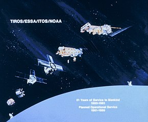
English: Diagram showing progression of meteorological satellites from TIROS I to TIROS-N |
| Date | |
| Source | http://www.photolib.noaa.gov/htmls/spac0474.htm |
| Author | National Oceanic & Atmospheric Administration (NOAA) |
NOAA In Space Collection, image ID: spac0474
Licensing
This image is in the public domain because it contains materials that originally came from the U.S. National Oceanic and Atmospheric Administration, taken or made as part of an employee's official duties.
|
File history
Click on a date/time to view the file as it appeared at that time.
| Date/Time | Thumbnail | Dimensions | User | Comment | |
|---|---|---|---|---|---|
| current | 07:50, 4 June 2025 | | 2,048 × 1,697 (2.2 MB) | wikimediacommons>4throck | improve color |
File usage
There are no pages that use this file.